A birthday GPS
August 19, 2023 | electronicsAround seven years ago I bought a Raspberry Pi, a GPS HAT, and a webcam. The idea was to build a simple device to attach to bike handlebar bag and generate a geotagged timelapse of a bike tour. Alas, I became obsesed with algebraic geomtery. I ended up doing nothing but mathematics for four years, completely forgotting about my electronics box… Until a few months ago.
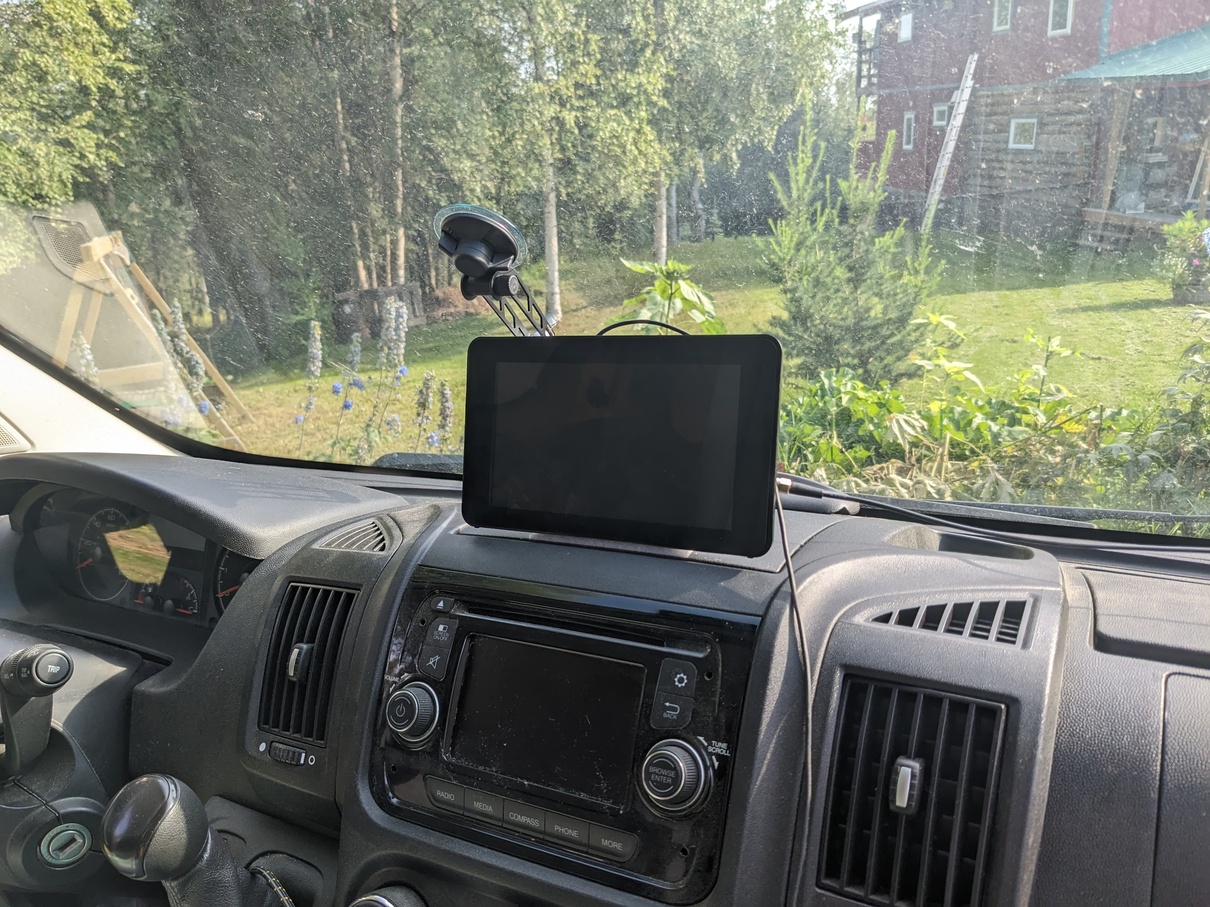
My parents are really into the idea of vanlife. Over the past several years they have slowly turned a Promaster into a really cool adventure camper. With my dad’s birthday coming I up, I had the idea to drag my old GPS project out from the basement and construct a dashboard console for their van.
I had a 7 inch touchscreen kicking around from an unrelated electronics project, and so it seemed that I had everything I needed to get started.
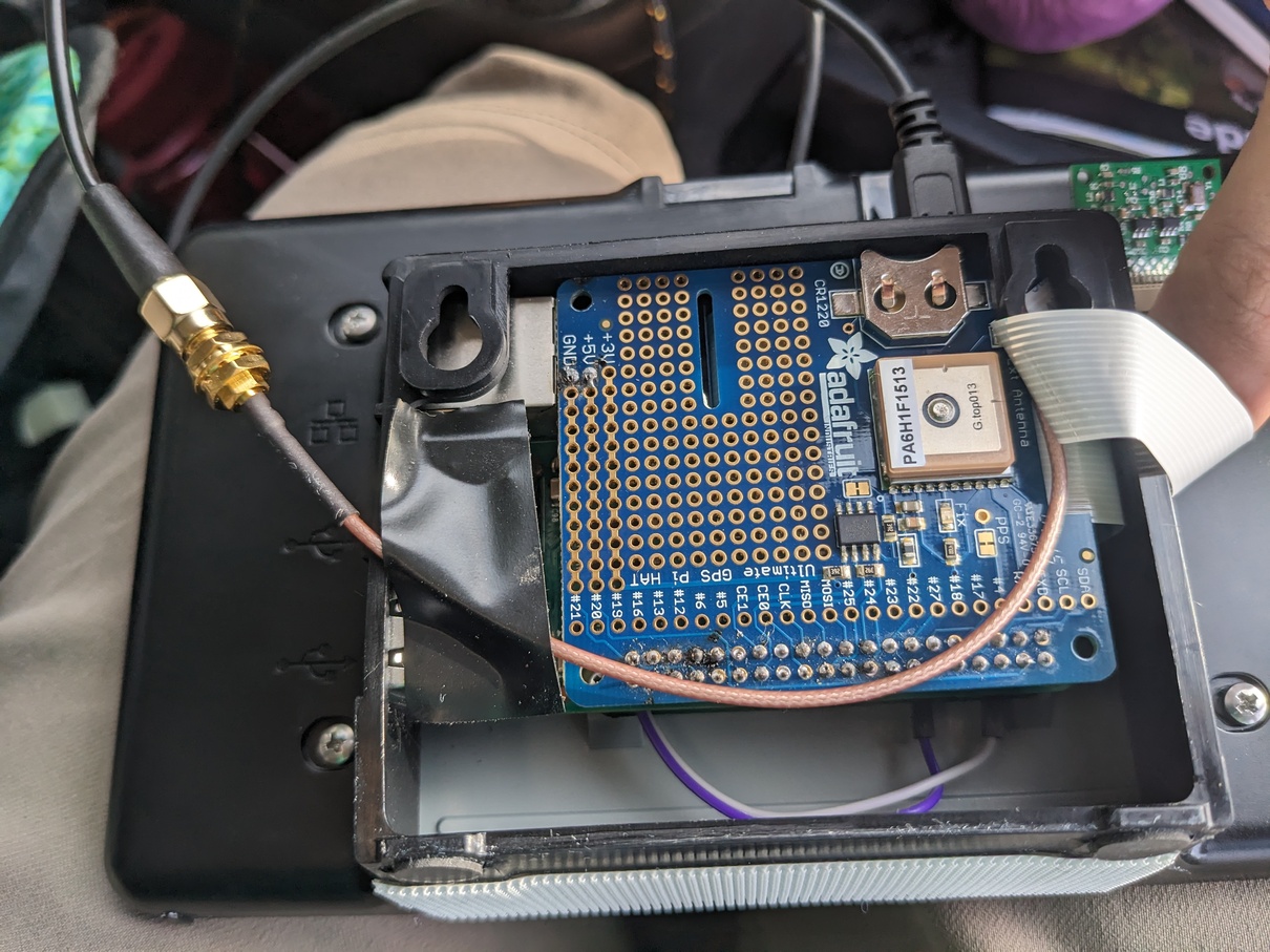
The first step was to solder the GPS HAT pins, and also solder a pair of wires to connect the touchscreen to the +5v and GND lines on the GPS HAT (since the hat commandeers all of the Pi’s GPIO pins).
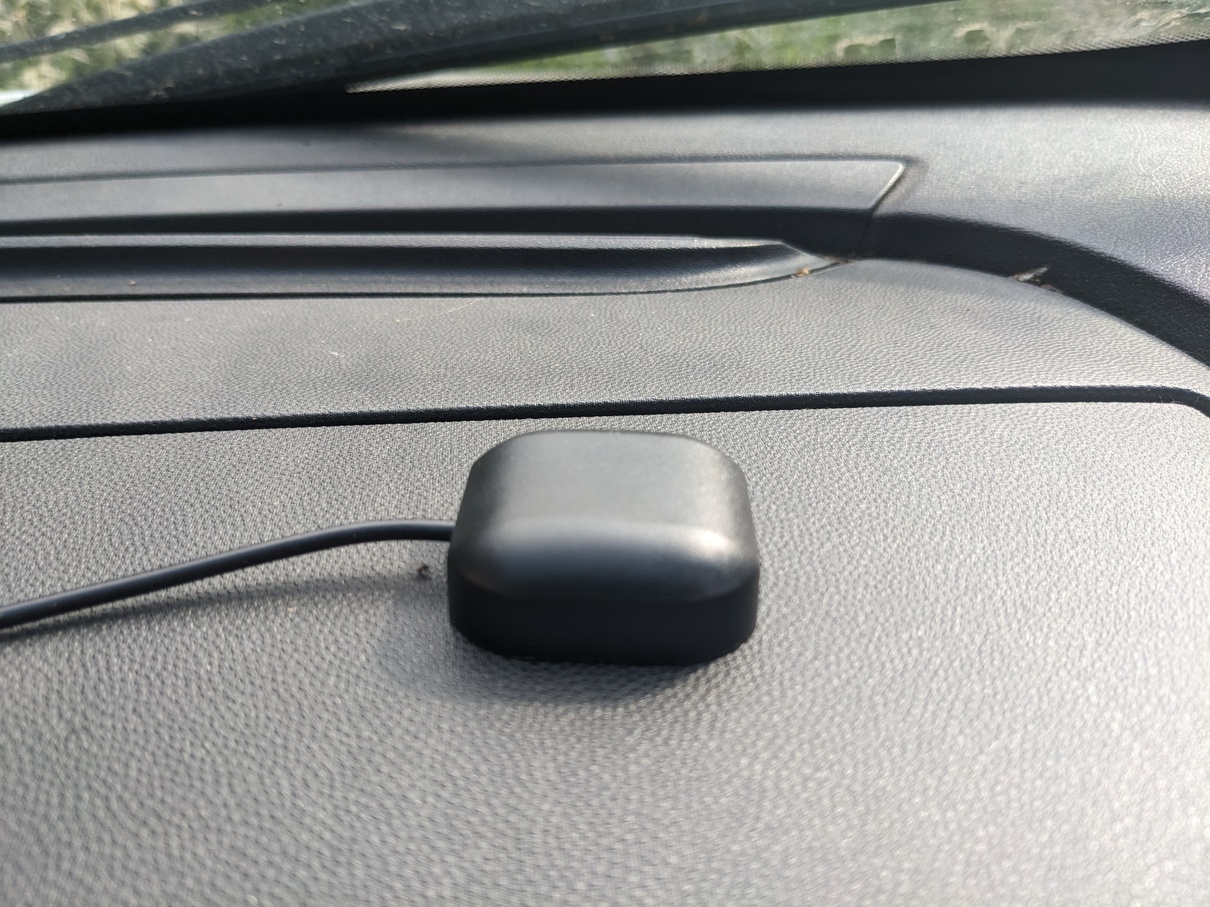
Next, I dumped the lastest Raspbery Pi OS image onto a 32GB micro SD card and booted the thing up. Setting up up gpsd was easy enough, I simply followed the provided instructions. Realizing that a GPS antenna needs to have a view of the sky, I bought an external antenna that could be placed out on the roof of the van.
I was finally at the point where I could think about software. I first planned to use an editor like Viking with OpenStreetMaps (OSM) data. Unfortunately, the Viking interface was far from ideal on a small touch screen, and it had far more features than my device needed. So I needed a new map viewer.
It turns out, I also needed new maps. It is simple enough downloaded OSM files for the entire US, Mexico, and Canada. However, the raw data available from OpenStreetMaps is just that: binary data (or XML data). In order to actually view a map using such a file, a set of 256x256 pixel map tiles (or vector tiles) must be rendered for the given region and zoom level.
OSM provides their own tile server, but many of the places that my parents plan to travel will not have cell service. I couldn’t just pull tiles from OSM on the fly.
The birthday was closing in, and I wasn’t having much luck. I started planning to buy a different present and look into a longer term project that involved writing a touch screen friendly map viewer myself.
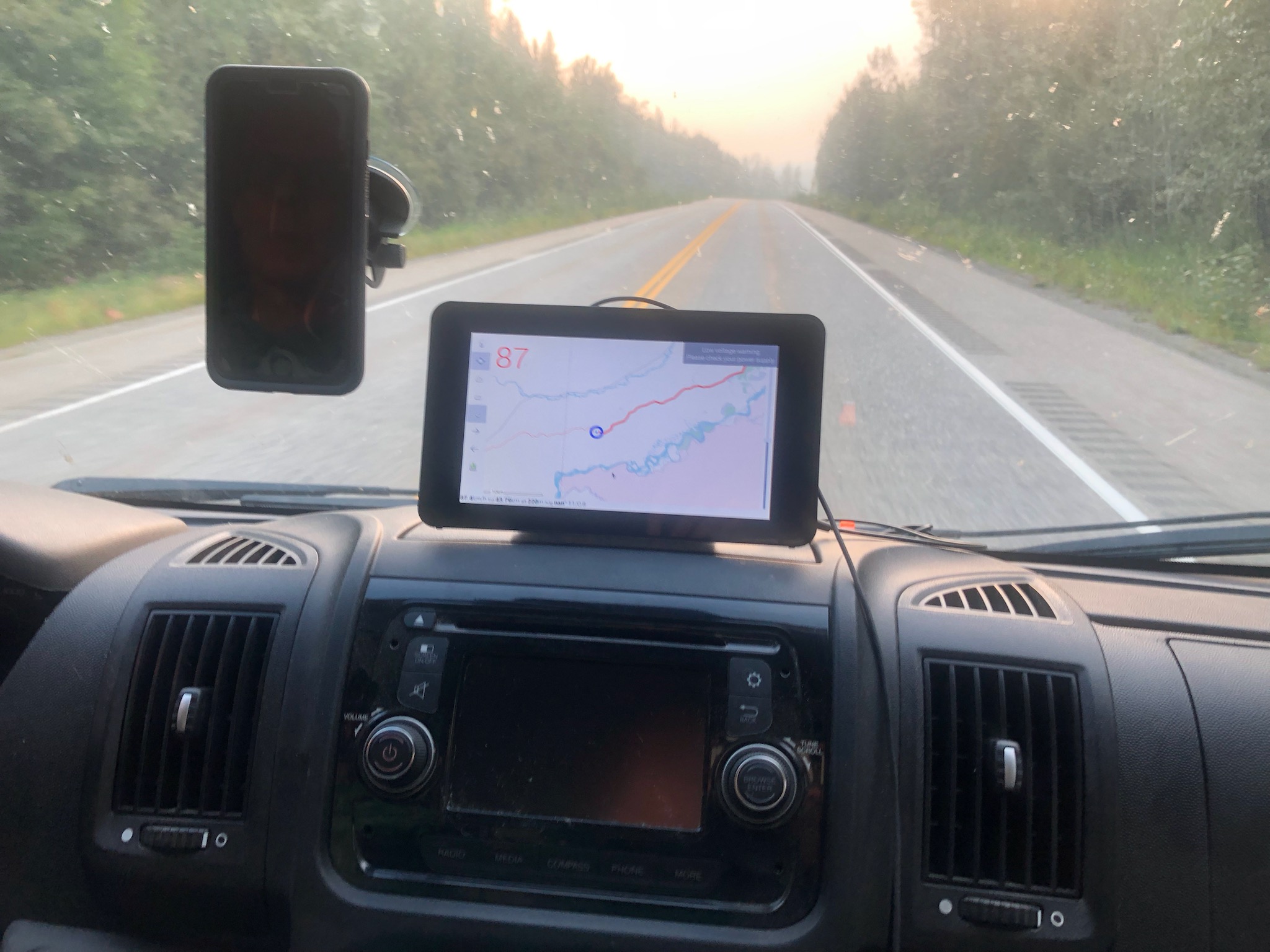
When all seemed lost, I stumbled upon FoxtrotGPS! Foxtrot is a wonderfully lightweight piece of software, designed specifically for small touchscreen devices. It provides a built in way to cache maps for offline use by simply downloading tiles for a region at selected zoom levels (you can specify which tile server to use).
I set up a systemd unit to start gpsd and load FoxtrotGPS in fullscreen when the system boots. I cached the maps for my parents’ next planned trip and got the system working in the nick of time.
Unfortunately, my work is not done. Caching tile images at all necessary zoom resolutions for any significant region would take an inordinant amount of space. The raw OSM data is far more practical to use: the entire North American region is only on the order of several gigabytes. My new plan is to follow a process something like this guide to set up a local tile server to render maps on the fly.